Finally I have arrived at Don Det, one of many islands making up the Si Phan Don (Four Thousand Islands) archipelago on the Mekong river. Si Phan Don is located on the southernmost of Laos, next to the Cambodian border. It is extremely laid back place – you can easily relax yourself in the hammock and watch the days go by. I got myself a comfy bungalow on the riverside, with bathroom inside, small veranda with hammock and such pleasure costed me just 30,000 kip (about 3 euro, October 2014).
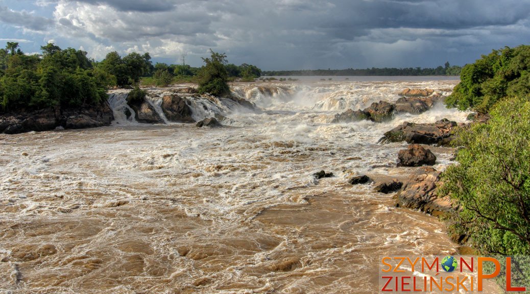
On the first day I only took some walk around the island and caught the sunset. On the second day I went out on a full day kayaking trip (price: 150,000 kip, about 15 euro). The main purpose of that trip was to see the largest waterfall in South East Asia – Khon Phapheng. It is not the most beautiful nor the highest of waterfalls. Being the largest cascade in South East Asia, Khon Phapheng offers impressive views on its up to 15 m high and 1 km wide rock formation, forcing the usually calm flow of the Mekong to roar through its narrow gorges and forming a natural obstacle for shipping. It is one of the reasons why China can’t be reached by Mekong only. Aggressive waters are crashing millions of litres on the rocks and into Cambodia every second.
The next day I went to Don Khong island, which at the time saw even fewer visitors than Don Det. I rented a bicycle and rode around the whole island – and apart from some modest temples I didn’t notice anything exceptional. I stayed there one night and came back to Thailand on the following day.
This way we have come to the end of my Laos trip in 2014. During this trip I have visited only the southern part of Laos, as I’ve seen the north earlier – I will surely post my photos and reports from previous trips later on.
Laos, Si Phan Don (Four Thousand Islands, A – Don Det, B – Don Khong)
, Laos - Don Det")
Wyspa Don Det, bardzo spokojne miejsce. Si Phan Don (Cztery Tysiące Wysp), Laos.
, Laos - Don Det")
Wyspa Don Det, bardzo spokojne miejsce. Si Phan Don (Cztery Tysiące Wysp), Laos.
, Laos - Don Det")
Wyspa Don Det, bardzo spokojne miejsce. Si Phan Don (Cztery Tysiące Wysp), Laos.
, Laos - Don Det")
Wyspa Don Det, bardzo spokojne miejsce. Si Phan Don (Cztery Tysiące Wysp), Laos.
, Laos - Don Det")
Zachód słońca widziany z wyspy Don Det, bardzo spokojne miejsce. Si Phan Don (Cztery Tysiące Wysp), Laos.
, Laos - Don Det")
Zachód słońca widziany z wyspy Don Det, bardzo spokojne miejsce. Si Phan Don (Cztery Tysiące Wysp), Laos.
, Laos - Don Det")
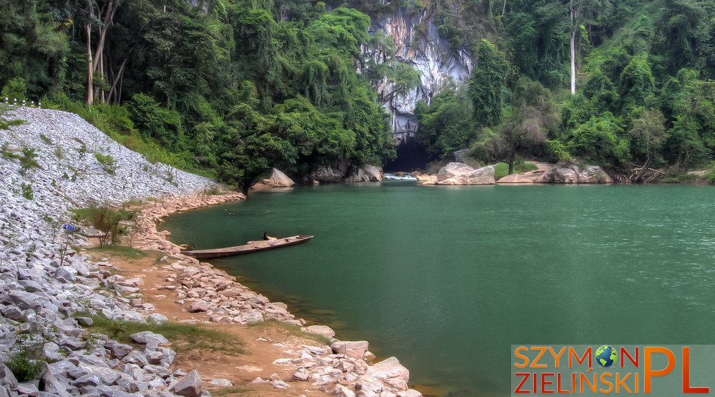
Okolice Don Det, podczas wycieczki kajakowej. Si Phan Don (Cztery Tysiące Wysp), Laos.
, Laos - Don Det")
Okolice Don Det, podczas wycieczki kajakowej. Si Phan Don (Cztery Tysiące Wysp), Laos.
, Laos - Don Det")
Okolice Don Det, podczas wycieczki kajakowej. Si Phan Don (Cztery Tysiące Wysp), Laos.
, Laos - Don Det")
Okolice Don Det, podczas wycieczki kajakowej. Si Phan Don (Cztery Tysiące Wysp), Laos.
, Laos - Don Det")
Transfer z miejsca na miejsce w zatłoczonym pick-upie. Wycieczka kajakowa. Si Phan Don (Cztery Tysiące Wysp), Laos.
, Laos - Don Det")
Świątynia przechowująca jakieś święte drzewo, po drodze do wodospadu Khon Phapheng. Si Phan Don (Cztery Tysiące Wysp), Laos.
, Laos - Don Det")
Świątynia przechowująca jakieś święte drzewo, po drodze do wodospadu Khon Phapheng. Si Phan Don (Cztery Tysiące Wysp), Laos.
, Laos - Don Det")
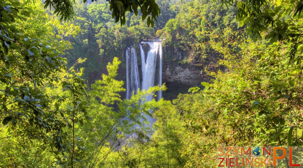
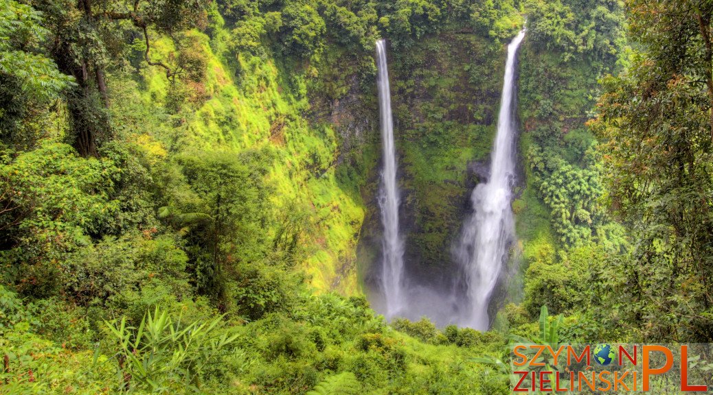
Największy wodospad w Azji Południowo-Wschodniej – Khon Phapheng, do 15 m wysokości i ok. 1 km szerokości formacje skalne. Si Phan Don (Cztery Tysiące Wysp), Laos.
, Laos - Don Det")
Ja i największy wodospad w Azji Południowo-Wschodniej – Khon Phapheng, do 15 m wysokości i ok. 1 km szerokości formacje skalne. Si Phan Don (Cztery Tysiące Wysp), Laos.
, Laos - Don Det")
Największy wodospad w Azji Południowo-Wschodniej – Khon Phapheng, do 15 m wysokości i ok. 1 km szerokości formacje skalne. Si Phan Don (Cztery Tysiące Wysp), Laos.
, Laos - Don Det")
Największy wodospad w Azji Południowo-Wschodniej – Khon Phapheng, do 15 m wysokości i ok. 1 km szerokości formacje skalne. Si Phan Don (Cztery Tysiące Wysp), Laos.
, Laos - Don Det")
Największy wodospad w Azji Południowo-Wschodniej – Khon Phapheng, do 15 m wysokości i ok. 1 km szerokości formacje skalne. Si Phan Don (Cztery Tysiące Wysp), Laos.
, Laos - Don Det")
Największy wodospad w Azji Południowo-Wschodniej – Khon Phapheng, do 15 m wysokości i ok. 1 km szerokości formacje skalne. Si Phan Don (Cztery Tysiące Wysp), Laos.
, Laos - Don Det")
Duży ślimak na ścieżce na wyspie Don Det. Si Phan Don (Cztery Tysiące Wysp), Laos.
, Laos – Don Khong")
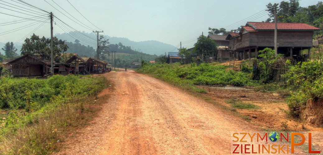
W drodze na Don Khong. Si Phan Don (Cztery Tysiące Wysp), Laos.
, Laos – Don Khong")
W drodze na Don Khong. Si Phan Don (Cztery Tysiące Wysp), Laos.
, Laos – Don Khong")
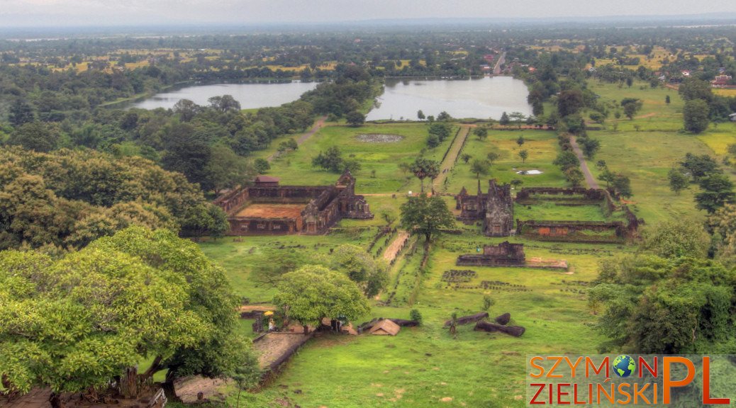
Świątynia na wyspie Don Khong. Si Phan Don (Cztery Tysiące Wysp), Laos.
, Laos – Don Khong")
Świątynia na wyspie Don Khong. Si Phan Don (Cztery Tysiące Wysp), Laos.
, Laos – Don Khong")
Świątynia na wyspie Don Khong. Si Phan Don (Cztery Tysiące Wysp), Laos.
, Laos – Don Khong")
Świątynia na wyspie Don Khong. Si Phan Don (Cztery Tysiące Wysp), Laos.
, Laos – Don Khong")
Świątynia na wyspie Don Khong. Si Phan Don (Cztery Tysiące Wysp), Laos.
, Laos – Don Khong")
Świątynia na wyspie Don Khong. Si Phan Don (Cztery Tysiące Wysp), Laos.
, Laos – Don Khong")
Świątynia na wyspie Don Khong. Si Phan Don (Cztery Tysiące Wysp), Laos.
, Laos – Don Khong")
Starsza kobieta na wyspie Don Khong. Si Phan Don (Cztery Tysiące Wysp), Laos.
, Laos – Don Khong")
Tęcza na wyspie Don Khong. Si Phan Don (Cztery Tysiące Wysp), Laos.
, Laos – Don Khong")
Moja pyszna kolacja na wyspie Don Khong – ryba przygotowana w mleku kokosowym. Si Phan Don (Cztery Tysiące Wysp), Laos.


")
")
")
")
")
")
")
")
")
")
")
")
")
")
")
")
")
")
")
")
")
")
")
")
")
")
")